
Table of Contents
- 1 Cycle the Ring of Kerry
- 2 The Ring of Kerry Ireland
- 3 What is the Ring of Kerry?
- 4 What are the Ring of Kerry highlights?
- 5 What is the Ring of Kerry Charity Cycle?
- 6 Ring of Kerry – Cycle Clockwise or Counterclockwise?
- 7 When is the best time to cycle the Ring of Kerry?
- 8 Ring of Kerry Cycling Route
- 9 Ring of Kerry Itinerary
- 10 Tips for Cycling the Ring of Kerry – What to Know Before You Go
- 11 Ring of Kerry Virtual Challenge
Cycle the Ring of Kerry
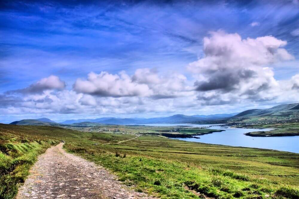
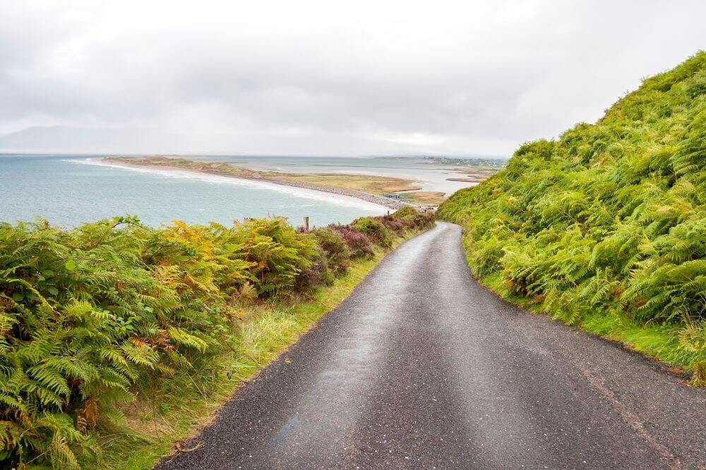
There are many beautiful cycling routes around the world. The Ring of Kerry cycle is one of the best of them and features on the bucket lists of many people.
This route is distinguished from others for its combination of its spectacular views, challenging, but manageable terrain, rich history and interesting attractions, as well as charming Ring of Kerry towns with great food, accommodation and Irish hospitality.
The Ring of Kerry Ireland

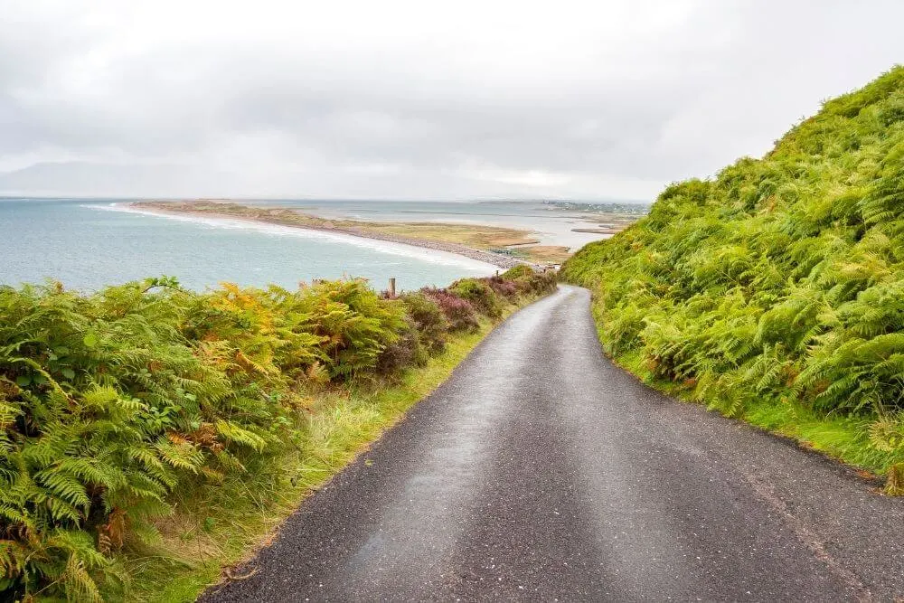
Each year many people fall in love with Killarney and the Ring of Kerry in Ireland. Most of these people travel the Ring of Kerry route either by car or bus. From the multitude of glowing reviews, you can see that a trip around this loop is a memorable and unique insight into one of Ireland’s best known highlights and a favourite along the Wild Atlantic Way.
However, if you really want to immerse yourself in this spectacular part of Ireland at the western edge of Europe, it might seriously be worth considering traveling the Ring of Kerry by bike. Not only will you be able to slow down and explore at your own pace, you will soak up the sights, sounds and smells of the Irish countryside.
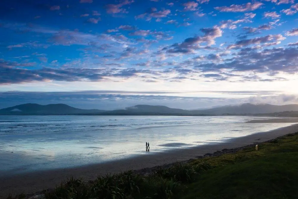
Cycling the Ring of Kerry allows you to taste the salty air blowing in from the Atlantic Ocean, take a refreshing dip in the sea on one of the many brilliant beaches, (occasionally) feel the rain pitter patter on your skin (hopefully not too often!) and of course, sample the local cuisine and hospitality.
You can decide to plan the trip yourself or go as a guided cycling tour, whichever suits you and your budget.
What is the Ring of Kerry?
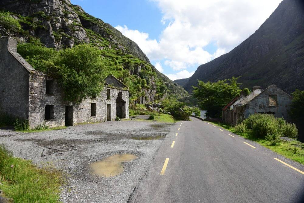
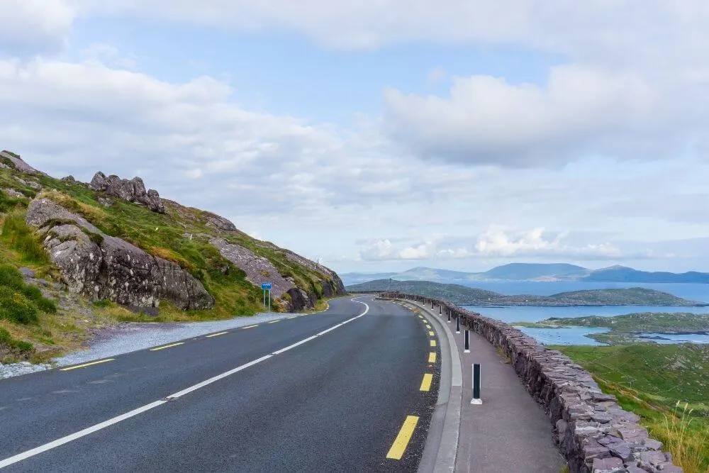
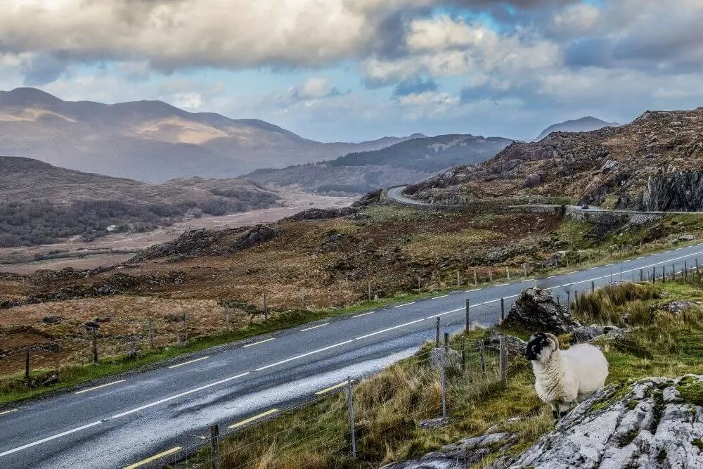
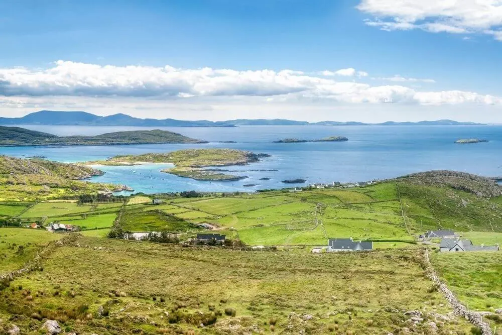
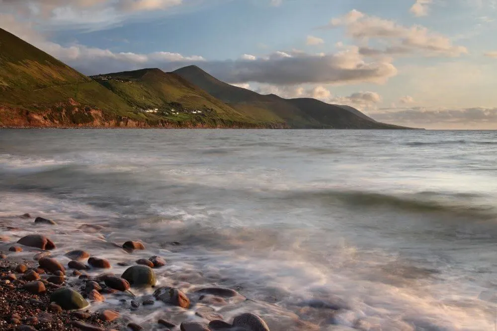
The Ring of Kerry is a loop route that mostly hugs the coastline of the Iveragh Peninsula in County Kerry and it makes up a section of the Wild Atlantic Way coastal route.
The Kingdom of Kerry, as it is sometimes known, is one of the most scenic of all of the Irish counties and it can be said that the Ring of Kerry is possibly the best of all Kerry tours.
Some of Kerry’s best-known highlights, including Killarney National Park with its three lakes, Macgillycuddy Reeks mountain range, Torc Waterfall, rocky cliffs, idyllic beaches and a few quiet pretty bays are found along the Ring of Kerry route.
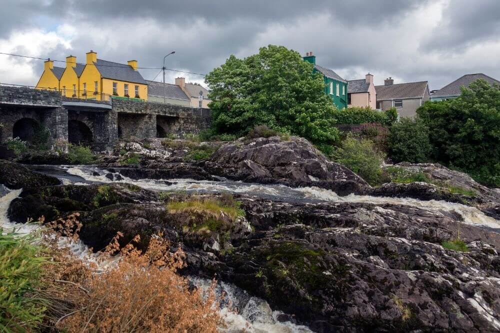
Dotted along the way there are some delightful towns and villages, including Kenmare, Sneem, Waterville, and Glenbeigh, to name but a few.
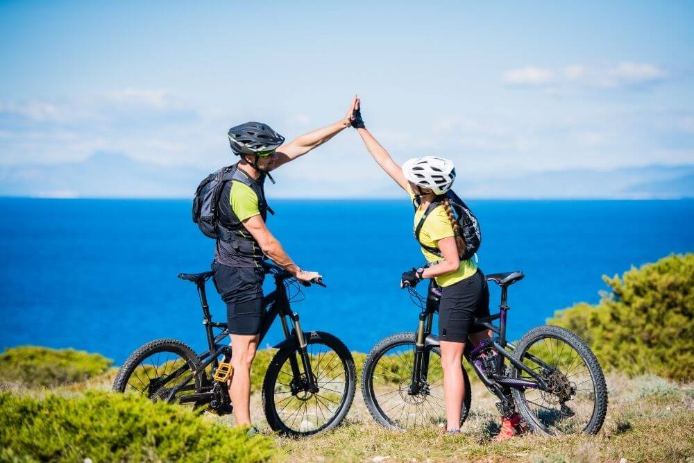
Can you cycle the Ring of Kerry?
Yes, it is possible to cycle the Ring of Kerry. A good level of fitness is required for the route, which is typically described as difficult.
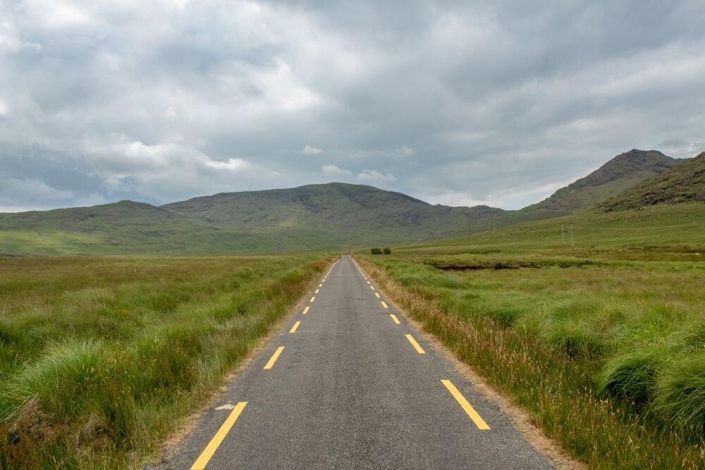
Along the route, the terrain in places is rough and steep. The route follows sections of main road, as well as smaller side roads with poor surfaces.
Cyclists must be comfortable cycling with the usual road traffic. This is heavier during the summer months.
Weather conditions, which can be windy or wet (at all stages of the year) also impact the cycling conditions.
Where does the Ring of Kerry start?
Many cyclists also opt to complete the loop from Killarney. Depending on the time of year and amount of (tourist) traffic on the road, it might be it is worth considering starting in one of the other towns along the way, such as Kilorglin or Kenmare.
When driving by car, Killarney is usually the most convenient place to start and finish the Ring of Kerry.
How long is the Ring of Kerry?

The traditional route of the Ring of Kerry is about 171 km or 106 miles.
The distance of the Ring of Kerry can be lengthen by adding some very worthwhile detours. Alternative variations of the loop include the Gap of Dunloe and Black Valley, as well as the Skellig Ring and Valentia Island. This route is about 216 km (134 miles).
How long does it take to cycle the Ring of Kerry?
It is best to plan about at least three to four days to cycle the Ring of Kerry, even better if you can spread it over a week. This will allow ample time to appreciate the route at your own pace, stop along the way and enjoy the many worthy highlights and authentic experiences that the Ring of Kerry has to offer.
Of course, how long to cycle the Ring of Kerry is a difficult question. Depending on your fitness levels and the weather conditions, it is possible to cycle the entire Ring of Kerry route in a day (216 km /134 miles), but this doesn’t allow for much time to stop and enjoy the views, which on this route is a must!
How long to drive the Ring of Kerry?
The Ring of Kerry drive is a popular day tour by car or bus and is often completed in a day. At this pace, it is a whistle-stop tour of the main highlights.
If you really want to appreciate all that the route has to offer and connect with the authentic Irish experiences along the way, it is best to spread the trip over 2-3 days at least, depending on the itinerary.
What are the Ring of Kerry highlights?
- Stunning panoramic vistas (e.g. Ladies View, Coomakista, Mountain Stage)
- Beautiful beaches (e.g. Rossbeigh, Ballinskelligs, Derrynane)
- Archeological treasures (e.g. Iron Age stone forts, medieval castles and monasteries)
- Charming Towns and Villages (e.g. Kenmare, Sneem, Waterville, Ballinskelligs)
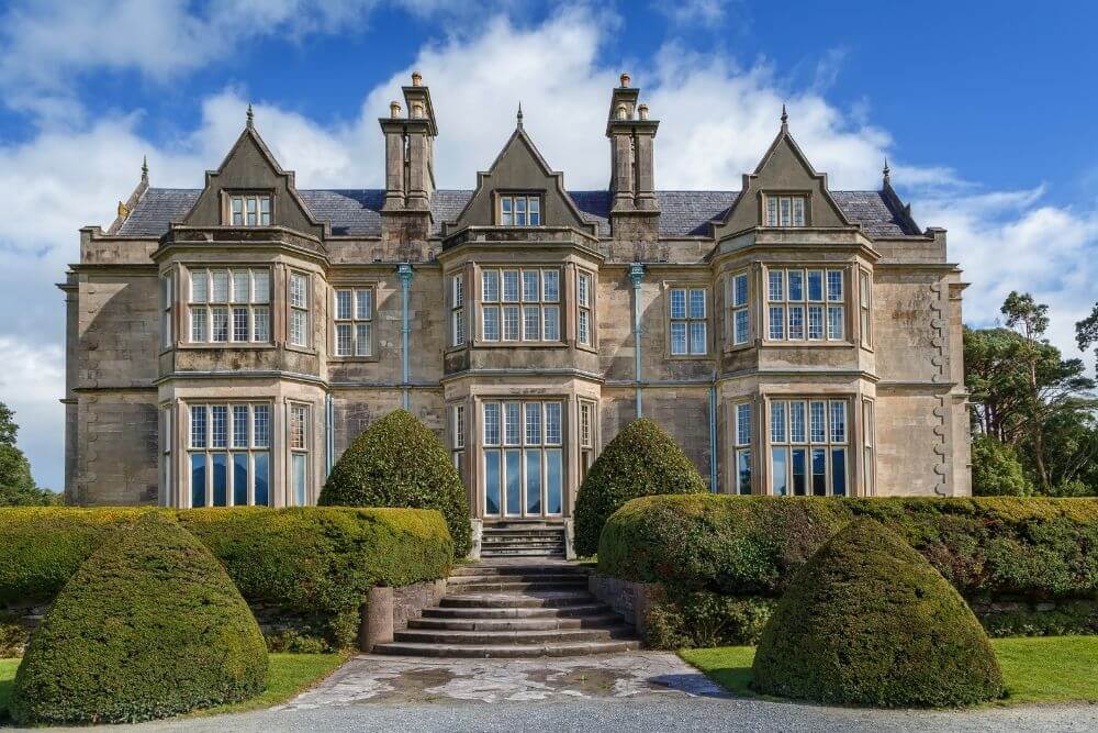
- Great Attractions (e.g. Muckross House, Day trip to Skellig Michael, Tetrapod trackway)
- Natural wonders (e.g. Kerry Dark Sky Reserve, unique flora and fauna)
What is the Ring of Kerry Charity Cycle?
Since the early 1980s, an annual charity cycle has taken place around the Ring of Kerry.
This charity cycle started out as a small event, which has grown considerably over the years in both terms of participant numbers and the funds raised for both local, as well as national charities. The number of cyclists taking part in the Ring of Kerry Charity Cycle 2022 is capped at 8000.
The Ring of Kerry Charity Cycle follows an anticlockwise direction around the Ring of Kerry with clear designated starting points spread out around the route to avoid congestion.
Registration for this event opens in February and the cycle takes place on the first Saturday of July. The Ring of Kerry Cycle Route map can be found here.
Take note!
Some road closures and traffic restrictions are in place around the Ring of Kerry on this day. If you have not registered for the cycle, you will not be allowed to cycle through the checkpoint on the closed sections of road!
Ring of Kerry – Cycle Clockwise or Counterclockwise?
The traditional starting point of the Ring of Kerry is in Killarney (although, you can start anywhere along the route). Many people wonder which direction to cycle the loop in.
For safety reasons it is recommended that the Ring of Kerry is cycled in a clockwise direction.
Overtaking maneuvers especially by large vehicles, such as trucks and tourist buses, are one of the main drawbacks faced by cyclists on Irish roads.
Generally speaking, larger vehicles, particularly tour buses tend to drive in a counterclockwise direction around the Ring of Kerry. By cycling in a clockwise direction, the likelihood of encountering such overtaking maneuvers is considerably reduced.
Another plus is that cyclists will be closer to the coastal views when they cycle in the left lane (don’t forget that in Ireland vehicles drive on the left side of the road!).
In an anticlockwise direction, there is always a lane of traffic between the cyclists and the views.
The traditional tourist Ring of Kerry cycle route follows a counterclockwise direction. It starts in Killarney and travels toward Killorglin and follows the route around the Peninsula.
The last stage of the cycle is then through Killarney National Park before finishing up again in Killarney.
The route outlined below follows the clockwise route around the Ring of Kerry.
When is the best time to cycle the Ring of Kerry?
It is best to attempt this cycle during the months with better weather and long hours of daylight.
During the peak tourist season of June, July and August (particularly the latter two months) traffic can be heavy, so it might be worth considering May and September, (or even April) as good alternatives.
Ring of Kerry Cycling Route
The route outlined below divides the route into four stages, traveling in a clockwise direction from Killarney. Whenever possible, some quieter side roads have been suggested.
Depending on how much time you have, the weather conditions and your fitness level, you can decide how many stages, or parts of the stages that you would like to do each day.
If you are looking for good places en route for supplies, a light lunch or evening meal, the following towns and villages have have a range of shops, dining and accommodation options:
What are the main towns along the Ring of Kerry?
- Kenmare
- Sneem
- Caherdaniel
- Waterville
- Portmagee
- Cahersiveen
- Glenbeigh
- Killorglin

To make the most of the trip, we have included some travel tips and suggestions for alternative routes, and plenty of ideas for some shorter (and longer) detours to make this fantastic cycle route even more memorable.
Definitely take some time to explore some side roads and boreen. Half the fun can be the sights you experience while getting a bit lost or sidetracked along the way!
Ring of Kerry Itinerary
Killarney to Kenmare and Sneem
Google Map of route from Killarney to Sneem via Moll’s Gap and Kenmare
This first stage of the cycle gets off to a fantastic start in Killarney National Park, home to the three picturesque lakes, Torc Waterfall, as well as Ross Castle and Muckross House and Gardens.
From here the route climbs toward Moll’s Gap, the highest point on the entire Ring of Kerry route at 260 elevation (850 feet). This can be a bit of a challenge, but the views along the way are worth it.
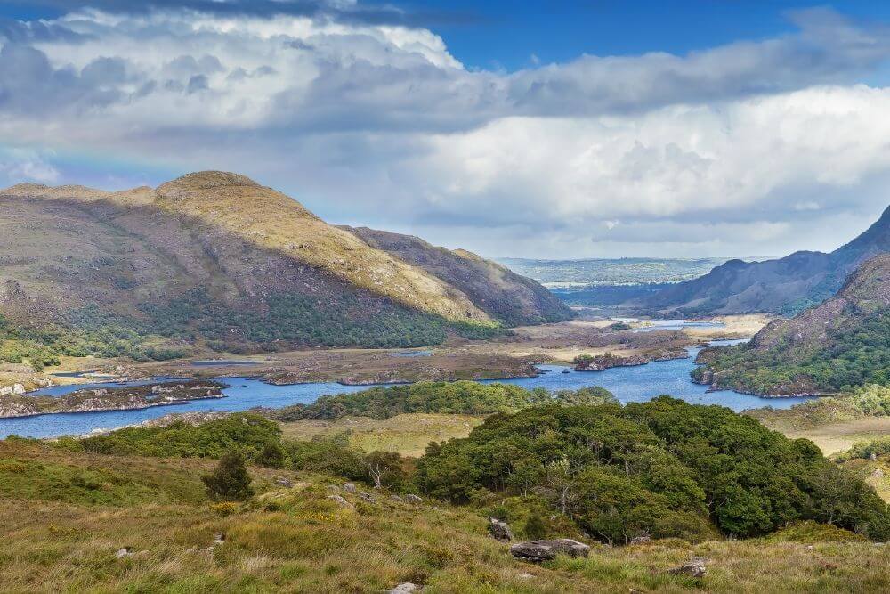

One such viewing point is Ladies View. This is a popular stopping point that offers an unrivaled panorama of the National Park, including Eagles Nest and Torc Mountain, which frame the lakes. Ireland’s highest mountain, Carrauntoohil in the MacGillycuddy Reeks is situated to the left (a little further west) of this view.
Lady’s View is said to have gotten its name from Queen Victoria’s ladies-in-waiting, who were very impressed by the vista during the visit of the Queen in 1861.
The climb to Moll’s Gap continues for another while through the stunning surroundings, before the descent into Kenmare.
Kenmare is a small, charming town with plenty of good food, hotels and B&B accommodation with full Irish breakfast, if that takes your fancy.
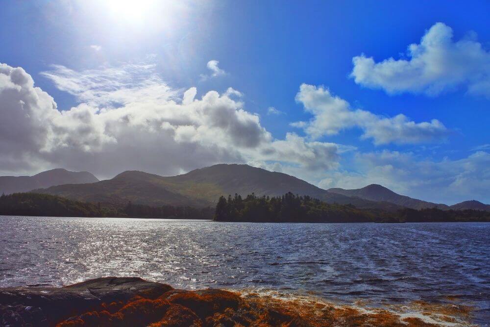

The route from Kenmare to Sneem follows a reasonably straight stretch of coastal route with superb sea views of Kenmare Bay. There are some gentle hills along the way, but nothing too strenuous.
To vary the scenery, it is possible to enjoy the coastal road, with the picturesque Blackwater for the first part of the route and travel a little inland.
In Tahilla by the church, take the road towards Letterfinish and join the quiet, rural R568 road in the direction of Sneem.
In Sneem, there are plenty of accommodation options, including B&Bs and a hotel, as well as shops and pubs.
There is also a campsite located closer to Caherdaniel (ca. 20 km away).
Alternative route:
Killarney – Gap of Dunloe – Moll’s Gap – Sneem
Google Map of route from Killarney to Sneem via Moll’s Gap
It is also possible to travel from Killarney, through the scenic Gap of Dunloe mountain pass and the Black Valley and join the route again at Moll’s Gap.
This is the more challenging route with some steeper unpaved sections, but it is also more stunning too.

At Moll’s Gap, it is possible to either follow the descent downhill to Kenmare along the main road (N71) or alternatively, take a rural road R568 to Sneem and bypass the coastal route from Kenmare to Sneem.
The R568 is a quieter, scenic road, which does not get the main traffic which brings you directly into the town of Sneem.
Handy Tip: It is always a good idea to start the cycle early in the morning to avoid some of the heavier traffic along the route.
An added advantage of an early start during this stage of the cycle might give you the opportunity to catch a glimpse of some wildlife, such as deer.
Along the Kenmare to Sneem stage of the cycle, there are not many options to purchase food and beverages, so make sure you have enough for the trip.
Sneem to Waterville
Google Map of route from Sneem to Waterville
This stage starts with a small hill outside of Sneem, which is shortly followed by expansive views of the rugged coastline.
There are many highlights along this stage that might be worth including in the itinerary, if the time can be spared. The map above only shows the route and not the detours along the way.
Be sure to check in advance which ones interest you!

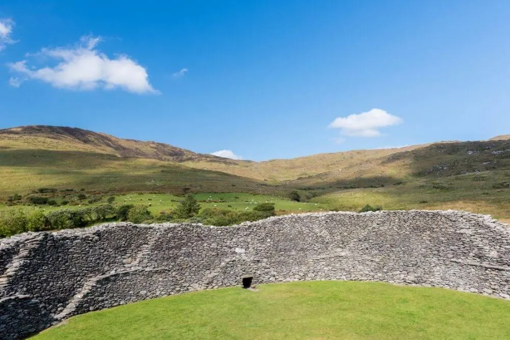
- Staigue Stone Fort, which dates back to the late Iron Age, was probably a defensive fort that can be reached by taking a detour north from Castlecover.
- Derrynane House and Gardens in Derrynane National Historic Park offers a refreshing break and is an ideal spot to get some refreshments and stretch your legs. It is the ancestral home of the influential Irish political leader, Daniel O Connell, known as “The Liberator”, who helped bring about Catholic emancipation in Ireland and is one of the key political figures in Irish history.
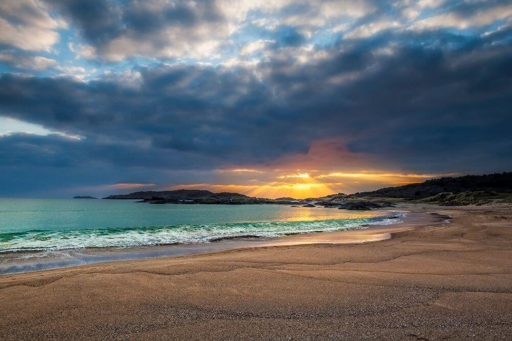
- Derrynane beach is another great detour and one of the Ring of Kerry sites not to be missed. Even the route to the beach is very picturesque; it is reached by a narrow road through woodland. This fine, sandy beach with its incredibly blue water epitomizes the unique beauty of the Ring of Kerry.
Take note that it is only safe to swim in the designated areas of the beach. Lifeguards are usually on duty during the summer, but take care to follow the swimming guidelines.
A dangerous rip current occurs on the section of the long beach.

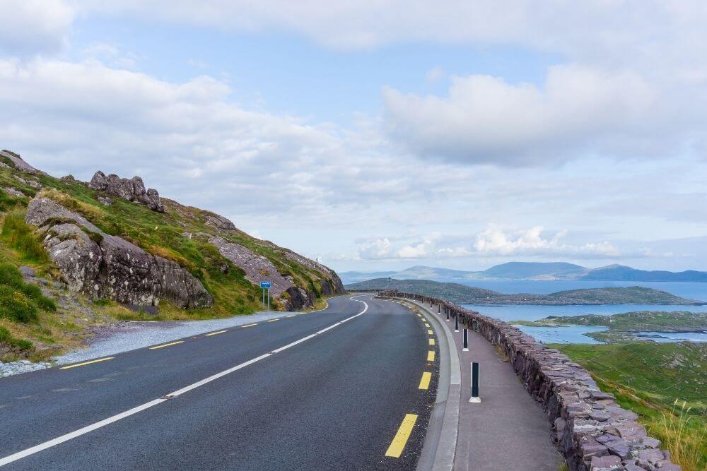
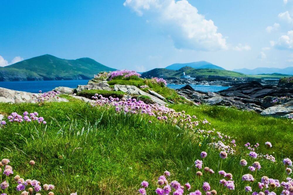
From Derrynane, there is another climb to the next impressive viewing point of Coomakista (also known as Com an Chiste Ring), which has a decent car park.
On a clear day, the breathtaking panoramic vista includes Abbey Island, Deenish Island and the larger Scariff Island, as well as views of Dursey Island and the Beara Peninsula. (See below for our tips about the night!)
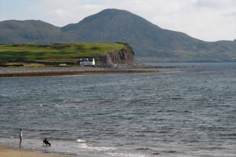
The route takes a long descent into Waterville, a lovely, small town with a very famous connection.
This was a favorite holiday destination of Charlie Chaplin and there is usually a Charlie Chaplin Comedy Festival in his honor each summer.
(There are plenty of accommodation options here if you want to do this stage over two days.)
Extra Tip: On a clear night, the remote viewing spot at Coomakista is a superb star gazing spot. In fact, the entire area from Waterville to Kells (measuring about 700 km2 or 270 square miles) is part of the Kerry International Dark-Sky Reserve.
Due to the fact that the area does not receive much light and dust pollution, when the skies are clear there are fantastic opportunities to view the night sky.
The Kerry reserve was the first reserve in the Northern Hemisphere and is only one of four Gold Tier Dark Sky Reserves in the world. This gives you an idea of how special this sight can be, especially on moonless nights!

Extra Extra Tip: If you want to have another alternative route back to Killarney, the Ballaghisheen Pass is an exceptionally scenic option.
Instead of taking the Ring of Kerry coastal route via Cahersiveen back to Killarney, it is possible to take this pass, which cuts through the middle of the Iveragh Peninsula.
From there, it is possible to head back towards Caragh Lake via Blackstone Bridge, for some other memorable highlights.
Google Map of route from Waterville to Killarney via Ballaghisheen Pass
This quiet route is completely underrated and well worth considering if you want to divert from the main Ring of Kerry route map.
The turn off for this pass is just after Waterville when traveling towards Cahersiveen.
Waterville to Cahersiveen
Google Map of route from Waterville to Cahersiveen, via the Skellig Ring and Valentia Island
It is possible to shorten the route and travel directly from Waterville to Cahersiveen along the N70, but this route excludes some great highlights.
It is well worth taking the Ring of Skellig route, which is an extra 18 km (or 11 miles) and then explore Portmagee and the unique attractions on Valentia Island.
The Skellig Ring route veers off the N70 after passing through Waterville and encompasses the Irish speaking area (or Gaeltacht) village of Ballinskelligs and its lovely beach along with Ballinskelligs Priory and ruined tower, known in the area as Ballinskelligs Castle.
Then the Skellig Ring route passes the Skelligs Chocolate Factory.
If you fancy sampling some traditional, as well as unusual chocolate favors, it is definitely the stop for you!
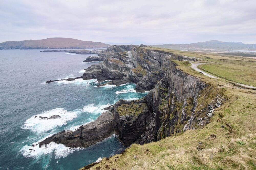

From here the route follows mostly along the coast, taking in the Coomanaspic Pass (or in Irish, Cúm an Easpaig).The Kerry Cliffs are another highlight located a little further on (roughly about 6 km after the Skellig Chocolate Factory).
These privately owned, spectacular cliffs are not as high as the Cliffs of Moher and definitely not as touristy, but they are very impressive in their own right.
The fishing town of Portmagee is the next stop on the map.
The Moorings Guesthouse in Portmagee was a favorite haunt of Mark Hamill and the cast of Star Wars when they filmed on the Skellig Michael. Find out more about the Star Wars connection here.
Portmagee is one departure point for the Skelligs Islands.
Be sure to book in advance if you want to actually land on Skellig Michael.
If you are short on time then a visit to the Skellig Experience Visitors Centre is a good way to discover more about Skellig Michael.
This small, rocky island continually battered by the waves of the Atlantic Ocean has a fascinating history as an early Christian settlement with stone dwellings that resemble beehive huts.
There is also a lighthouse on the island and it is famed for its wildlife.
The Skellig Islands are home to many seabirds, including puffins, shearwaters, razor bills and storm petrels. One of the largest colonies of gannets in the world is found on the Little Skellig.

Valentia Island is linked to the mainland in Portmagee via a bridge and there is a ferry connection on the far side of the island. The first successful Transatlantic Cable was connected from Valentia Island to Heart’s Content in Newfoundland, Canada.
It is also home to the Tetrapod trackway, which is a record preserved in stone of some of the oldest tetrapod footprints in the world, dating back ca. 385 million years ago!
After enjoying the superb views from Valentia Island, head towards the ferry from Knightstown where you can take a short 10 minute trip to Reenard Point. Be warned that this only operates between April and October!
Cahersiveen is only a short distance from here and a good place to stock up on any necessities, as well as plan an overnight stay.
Cahersiveen to Killarney
Google Map of route from Cahersiveen to Killarney via Rossbeigh Beach and Caragh Lake
The route from Cahersiveen to about Kells, involves an ascent, but there are plenty of mountain views along the way
Keep an eye out for the old railway line that used to connect Farranfore to Valentia Island.
The large Gleensk Viaduct and the tunnels carved through the rock are impressive features. (Plans are in progress to develop this disused railway into the South Kerry Greenway in the near future!)
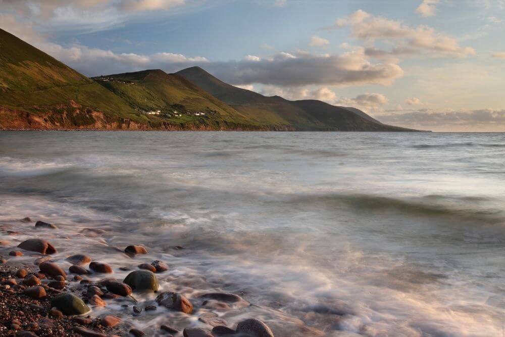
After passing the Mountain Stage viewing point, which gives unparalleled views over Dingle Bay and the Dingle Peninsula, Rossbeigh beach awaits at the end of a mostly downhill route.
Turn off the main road onto Drom West Road, which you can follow and then ride along the R564 back to the coast for an amazing overlook of Rossbeigh beach. The descent is steep here, so be careful.
This is a wonderful vista to enjoy while you recharge for the final leg of the trip back to Killarney. There are plenty of accommodation options in the Rossbeigh and Glenbeigh area if you want to make it a longer stop.
The route from Glenbeigh to Killorglin can be quite busy in high season, so it might be worth diverting from the main N70 route and taking a slight detour via Lough Caragh. In addition to the wonderful views of the lake and mountains in the background, this route is much quieter than the main road to Killorglin.
Killorglin is famed for its annual Puck Fair, which claims to be Ireland’s oldest festival. A wild goat being named king for the duration of the festival takes place between August 10 and 12 each year. (The tradition is that the king goat is placed in a cage on the top of a stand while the festival is being held. However, there is mounting opposition to this old tradition now on the basis of animal welfare.)
Once in Killorglin and over the bridge, it is possible to take another backroad in the direction of Lismacfinnan. While the side road may not be as well surfaced as the main road, there is considerably less traffic.
This covers about half of the remaining distance to Killarney and joins up with the main N72 near Beaufort. From there it is a flat cycle back into Killarney town and the Ring of Kerry is complete!

Tips for Cycling the Ring of Kerry – What to Know Before You Go
Ring of Kerry Cycle Difficulty Level:
A good level of fitness is required (ideally you should go cycling reasonably regularly to undertake this route)
There are difficult parts due to narrow winding roads, steep sections and surface conditions.
Ring of Kerry Cycle Distance:
The length of the Ring of Kerry when the traditional loop is taken is 171 km (106 miles).
The Ring of Kerry including the Gap of Dunloe, the Skellig Ring, Valentia Island and Lough Caragh is about 216 km (134 miles).
Ring of Kerry Best Time to Cycle:
Late April to about September is the best time to cycle the Ring of Kerry. There is likely to be more traffic on the roads in the summer months so a trip might be slightly more enjoyable in the shoulder season before before these months, for example late April and May.
Bicycle Type:
For ease of comfort, a road bike with slightly thicker tyres or a hybrid bike would be good options for this route.
Ring of Kerry Bike Rental and Repairs
There are several bike rental shops in Killarney and along the route there are also rental shops in Kenmare, Cahersiveen, Glenbeigh.
Most of these shops can also help sort out repairs.
Note: Make sure to thoroughly check the bike before you start to make sure that it is the right one for you and that it is in complete working order.
Traffic on Ring of Kerry:
In Ireland, traffic drives on the left side of the road. The Ring of Kerry is one of the most popular day trips by car and bus in Ireland, so particularly during high season there can be heavy traffic on the route.
Overtaking, especially by larger vehicles such as tour buses, is one of the main challenges of this route as there are very limited side lanes or hard shoulder sections. It is recommended that the route is cycled in a clockwise manner for safety because larger vehicles such as tour buses are recommended to travel the Ring of Kerry in an anticlockwise direction.
Keep road safety in mind at all times and be sure to take the necessary precaution by having all the right gear, including a helmet with you.
Handy Tip: It is a good idea to start early each morning. At this time of the day, there is usually less traffic on the roads. It also gives you more time to explore along the way.
Road Surface:
The roads used in this route vary, the majority of the route is asphalt but there are also sections with poor road surfaces that are bumpy so good tyres are a must.
Maps of the Ring of Kerry:
The Ordnance Survey Ireland Discovery Series Maps cover the Ring of Kerry in the following maps:
- No. 78 – Killarney and Kenmare
- No. 83 – Waterville, Cahersiveen and Valentia Island
- No. 84 – Sneem /Waterville
Tip: It is always best to opt for the folded water resistant maps, as they are likely to get wet when you read the Ring of Kerry map somewhere along the route.
(The No. 78 map is also great for hiking in Kerry)
If you are using mobile apps, then Komoot is a good option. It has plenty of detailed routes with the Ring of Kerry cycle map divided into manageable day sections. There is also additional background information that will help you plan and execute your trip.
What kind of weather to expect on the Ring of Kerry?
It is a good idea to attempt this route during the months where the weather is likely to be better and the hours of daylight are long.
While this route can be attempted all year round, the weather from about late April through to September is likely to be the most suitable.
Take a look at the month by month guide to weather here:
During the months of summer (June, July and August), the weather can be pleasant, but the traffic on the roads can be heavy, so opting for May or September might be a better all round option.
Word of Caution: This route can have bad weather at any time of year. The wind can be gusty at times, visibility can be poor due to mist and rain, so extra caution is required. Often, the weather is very changeable, so be prepared for all seasons!
Plus don’t forget the sunscreen in case you do encounter glorious weather!
Ring of Kerry Virtual Challenge
Do you want to cycle the Ring of Kerry, but live too far away? Or do you want a Ring of Kerry cycle training plan before attempting the real adventure?
The Ring of Kerry Virtual Challenge, is a mobile app where you can travel around the mystical Iveragh Peninsula virtually by submitting different exercises that you have completed.
These exercises, (which is not limited to cycling) are converted to equivalent distances traveled around the route. The more you exercise, the further around the route you travel virtually.
This can be a solo mission, or you can join a group, where the total virtual distance or activity is shared per person and at the end there is a unique medal to show off the achievement.
More supporting information about entry to the Kerry challenge can be found on the main Ring of Kerry Virtual Challenge page.
For more ideas about what to do in the area, check out Kerry or Waterville for some ideas about what to do when in the area!
This post may contain affiliate links. If you click on one of them, we might receive a small commission (at no extra cost to you). Thanks for your support!

(Irish Nature Expert and Celtic Enthusiast from Ireland)
Emer Walker, founder of LetsGoIreland.com, is a Cork native with profound expertise in Irish nature and ecology. Holding a PhD in Restoration Ecology and backed by extensive research in ecological sciences, she’s delved deep into Ireland’s natural wonders, from its rugged landscapes to its serene beaches. Emer’s passion also encompasses Celtic art and traditions. As a true authority on Ireland’s natural and cultural heritage, she invites readers through LetsGoIreland.com to immerse themselves in the authentic Irish experience.