Thanks for your support! (Photo: Nicolas Hoelscher via Canva)
Table of Contents
- 1 What is the Burren?
- 2 Where is the Burren in Ireland?
- 3 What is the Burren famous for?
- 4 Things to Do and See in the Burren County Clare Ireland
- 5 The Burren Walks
- 6 What to know before your visit the Burren, Co. Clare
- 7 Geology of the Burren
- 8 The Burren History
- 9 Flora and Fauna of the Burren
- 10 The Burren Facts
- 11 FAQ about the Burren Region Ireland
What is the Burren?
One of Ireland’s most unusual and intriguing landscapes is found in the Burren, County Clare. A visit to the area is certainly likely to be one of the most memorable parts of a trip along the Wild Atlantic Way Coastal Route.
The Burren Ireland
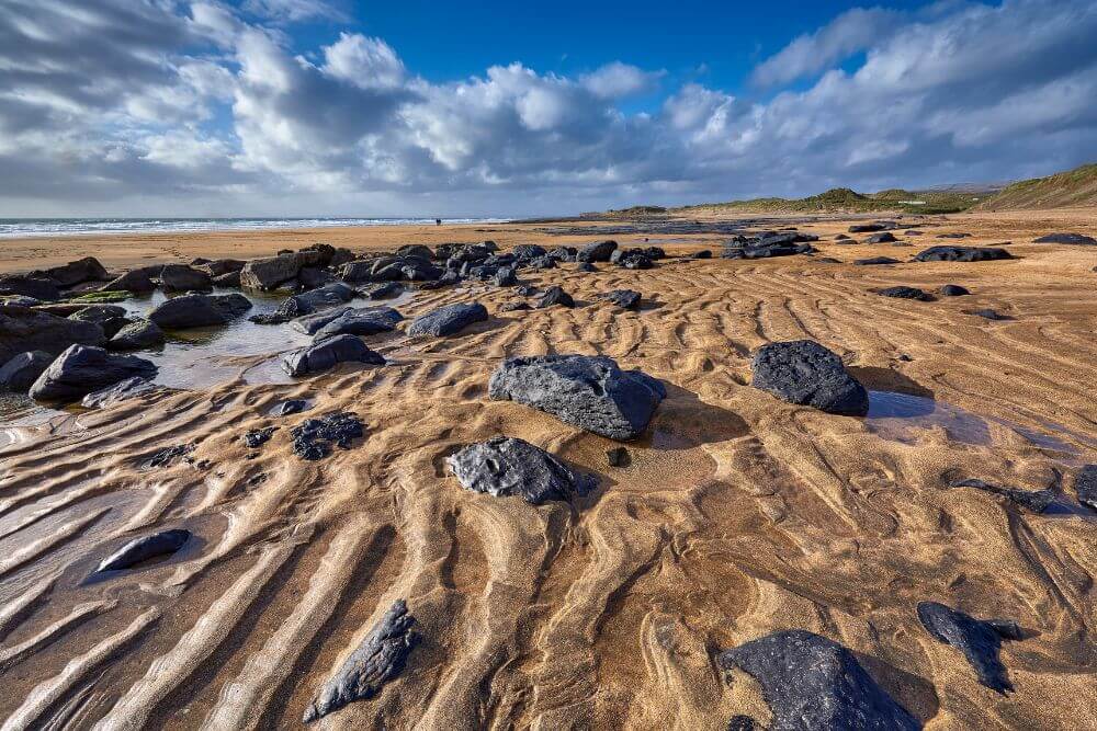
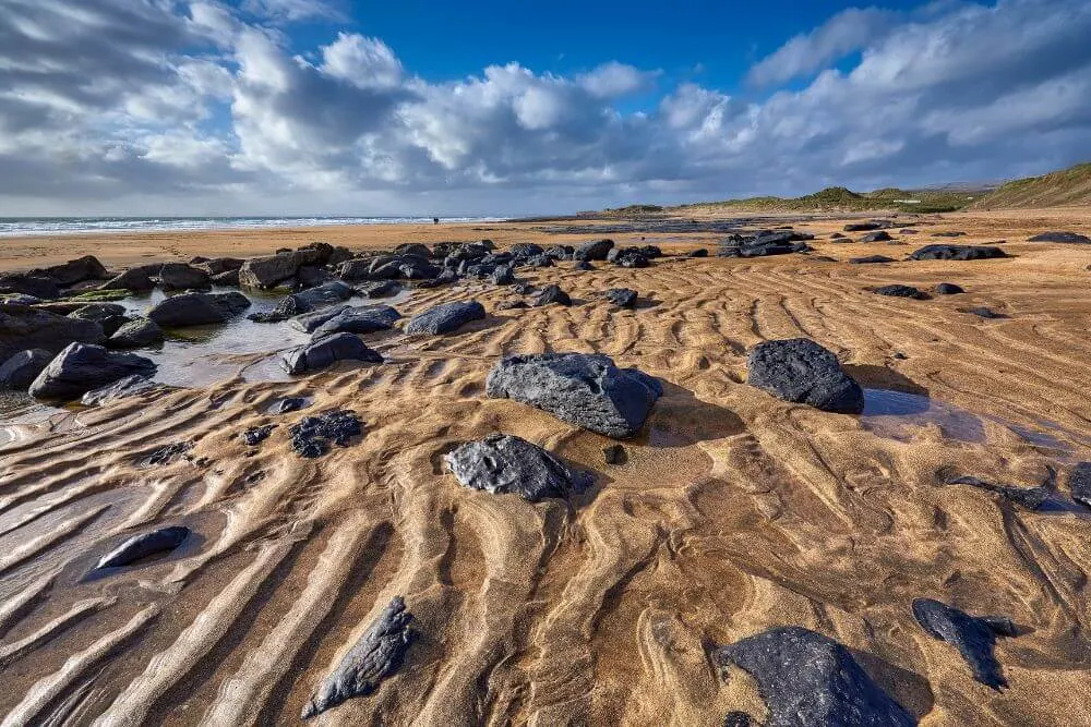
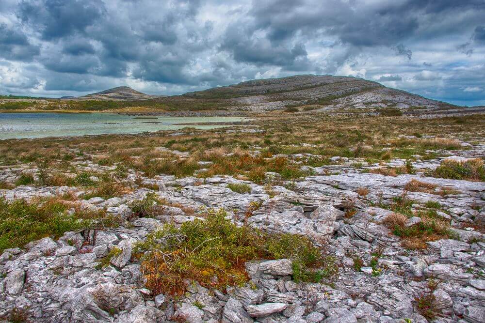
In a country famed for its green fields, the Burren seemingly barren limestone landscape stands out considerably. The landscape is reflected in the name of the region as the Burren comes from boíreann, which means a stony area or rocky place in the Irish language.
How big is the Burren?

While the rocky landscape is the iconic image of the Burren, in fact only about 250 square kilometres of the total 530 square kilometres consist of barren limestone pavement rock.
The rest is made up of a variety of different habitat types, including calcareous (or alkaline) grassland, hazel scrub, woodland (mostly hazel and ash), lakes and disappearing lakes (turloughs).
Where is the Burren in Ireland?
The Burren is situated in County Clare on the West Coast of Ireland.
County Clare’s other main tourist attraction, the Cliffs of Moher, is located not too far away from the Burren and day trips to the area usually combine visits to both (Did you know that there is a Harry Potter connection to the Cliffs of Moher? Read about it here). In fact, both the Burren and the Cliffs of Moher have been designated as being an area of significant geological interest by UNESCO and the area is known as The Burren and Cliffs of Moher Geopark (also: The Burren and Cliffs of Moher UNESCO Global Geopark).
A useful map of the Burren can be found here.
What is the Burren famous for?
The Burren in County Clare is internationally famous for the geology that formed the landscape, its long history of human settlement, traditional farming methods and impressive floral and animal diversity.
There are also many picturesque towns and villages that well worth a visit in the area, including Doolin (famed live Irish music), Lisdoonvarna (known for its Matchmaking Festival, mineral springs and the well-known song “Lisdoonvarna“, by the singer Christy Moore) and the charming Ballyvaughan looking out onto Galway Bay to name just a few.
Within the Burren lies the Burren National Park. This is the small of all 6 Irish national parks. Here you are likely to discover some fantastic hiking routes of the area, which will allow you to explore this unique landscape at your own pace.
Due to the unique landscape and nature of the region, quite a lot of the Burren is designated as a Special Area of Conservation under EU law.
Things to Do and See in the Burren County Clare Ireland

The Burren region in Ireland has an incredibly diverse range of things to do and see. Adding a day in the Burren to your travel itinerary is going to be a rewarding experience. Here is a list of some top 14 things to do and see in the Burren area:
- Hike around the Burren National Park or one one of the many other walking trails in the area, including the multi day Burren Way route
- Discover the amazing flora and fauna as part of a guided tour of the area
- Visit some of the many remarkable archaeological sites including the iconic Poulnabrone Dolmen and the impressive Caherconnell Stone Fort
- Take some time to explore the many charming towns and villages around the Burren area, such as Doolin, Lisdoonvarna, Kilfenora, Corofin and Ballyvaughan (or Ballyvaghan).
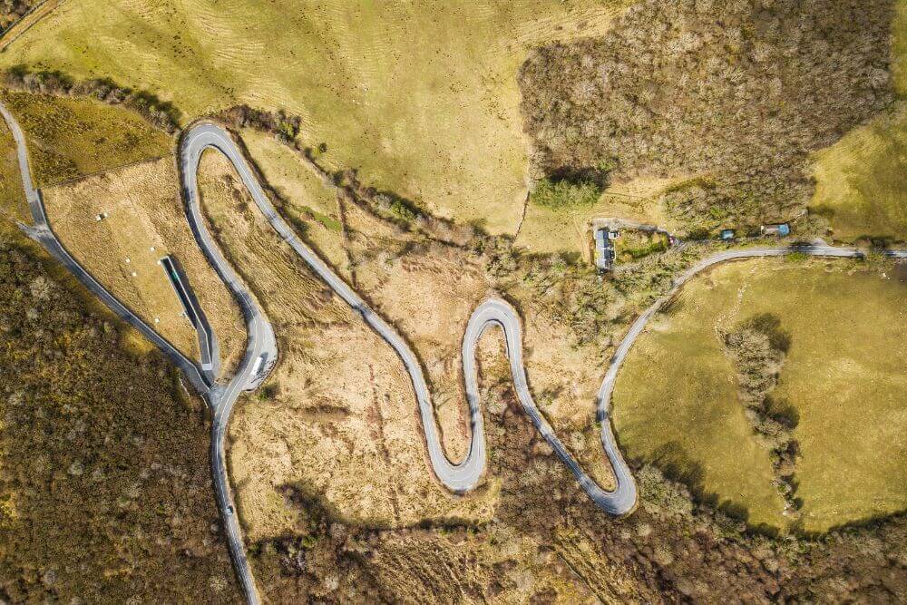
- Drive the scenic roads of the Burren, including the coastal road R477 and the twisty bends of Corkscrew Hill, where you can enjoy the stunning visita from the viewing point near the top.
- Explore some of the underground features of the Burren with a visit to Aillwee Cave and Bird of Prey Centre
- Go to one of the many great traditional Irish music sessions in the pubs of the Burren. Doolin, for example, is internationally famous for these trad sessions
- Take a wander around the spa town of Lisdoonvarna or even take part in the annual Matchmaking Festival that takes place there
- Walk around the ruins of the 13th century Corcomroe Abbey, which was founded by the Cistercians
- Discover the scents of the Burren in the Burren Perfumery
- Stop by the Burren Smokehouse Visitor Centre, where you will learn all about the process of smoking salmon. Other experiences such as beer brewing and storytelling are also offered here. (The Burren food is full of local, artisan products, be sure to check them out!)
- Book a visit to Father Ted’s house for afternoon tea (or just take a photo of the privately owned house from the road near Kilnaboy)
- Head to Fanore Beach and fit in a bit of surfing at this popular spot where waves roll in from the Atlantic Ocean
- Visit Lough Inchiquin near Corofin for some good angling options, particularly in springtime (before the water levels fall in summer)
- Plan a trip to the nearby Cliffs of Moher or take a ferry from Doolin to the Aran Islands
- Make the excursion to the Burren a day trip from Galway or vice versa. The Burren Galway distance is not too long (ca. 50 km from Ballyvaughan to the city center of Galway, which takes about an hour to drive).
The Burren Walks
Hiking in the Burren is a superb way to discover the natural beauty and diversity of this special landscape.
There are many different walking trail options in the Burren.
The Heritage Trails provided by the Burren and Cliffs of Moher GeoPark offer engaging insights into the towns and areas of interest in the region and are perfect for a shorter stroll if the weather is not the best.
Some of the best Burren walks that are not too challenging include:
- Carran Turlough Loop (5 km or 3 miles, roughly 1-1.5 hours, Difficulty Level: Easy and buggy friendly)
- Dromore Wood Loop Walk (6 km or 3.7 miles, ca. 1.5-2 hours, Difficulty Level: Easy)
- Ballyvaughan Wood Loop (8 km or 5 miles, ca. 2hrs-2 hours 30 mins, Difficulty Level: Easy)
For those of you looking for more of a moderate, challenging route, then the following options might be worth considering.

Other more moderate routes include:
- Caher Valley Loop (14.5km or 9 miles, 3-4 hours, Difficult Level: Moderate)
There are also longer Burren walks. Some of the routes are challenging and cover more difficult remote terrain, such as:
- Carron Loop Walk (9 km or 5.5 miles, ca. 3-4 hours, Difficulty Level: Difficult)
- Black Head Loop Walk (26 km or 16 miles, ca. 5-6 hours, Difficulty Level: Hard)
- Fanore to Ballyvaughan Trek (21 km or 13 miles, 5-6 hours, Difficulty Level: Hard)

The Burren Way
The Burren Way is a 114 km (70 miles) walking route across the Burren, Co. Clare that usually takes about 5 days to walk. There are some additional extra sections, which can extend the route to about 123 km (76 miles). This superb walk passes through the most beautiful parts of the Burren and takes in the sights of Doolin, Caherconnell Fort and Lough Inchquin.
There are 6 trailheads (Lahinch in the south west of the Burren, Doolin, Lisdoonvarna, Ballyvaughan, Carran, Corrofin and Tubber), with options to stop overnight in the towns along the way. Generally each section can be completed in a day by walkers of average fitness.
The terrain is mixed and includes a variety of green roads, footpaths, minor roads and grassy or rocky tracks.
A Burren Way Walking route is available here: Map Burren Way.
Walks in the Burren National Park

There are 7 marked walks spread between the Burren National Park and the nearby Slieve Carran Nature Reserve.
Exploring the Burren National Park by foot enables you to experience impressive views of Mullaghmore and the different habitats that are present in this park. Perhaps you might be lucky enough to see some of the native flora and fauna of the region.
Here is a taste of some of the Burren National Park Walks:
- White Route or Nature Trail (1.5 km or 1 mile, ca. 40 minutes, Difficult level: Moderate)
- Orange Route (Knockaunroe Turlough) (1.3 km or 0.8 mile, ca. 30 minutes, Difficulty level: Moderate)
- Mullaghmore Loop Walk Burren (7.5 km, ca. 3 hours, Difficulty Level: Very Difficult with remote sections)
The Burren Map trails can be found here.
Travel Tips for the area:
- Some walks through the Burren National Park are serviced with a free tourist bus during the summer months, which helps make the walks more accessible to the public. Check the Burren National Park website for the shuttle bus information.
- For those of you interested in doing the White Trail, there is also a free app available for download for iPad and iPhone for this route available (in multiple languages, including German). More information here
If you plan on visiting the Burren, one of the best ways to learn more about the area is to take part in a tour with a knowledgeable guide.
The Burren National Park offers free guided tours, but due to demand, it is necessary to book this service in advance (Details can be found here). On demand, the tour can also focus on special subject areas such as the geology or archeology of the Burren or the species of butterflies or orchids that are found in the Burren region.
There are also guided walks of the Burren by licensed private individuals. This can focus on certain topics of interest too. In addition to the geology and archaeology, some also focus on the folklore associated with the Burren so it is worth check out beforehand what would suit you best. The Heart of the Burren Walks is one of the best providers in the area.
What to know before your visit the Burren, Co. Clare
Without some background information, it is easy to underestimate how unique the Burren area is. This guide is a handy starting place and aims to give you a wide introductory knowledge base about the Burren including:
- How the Burren formed
- Ancient monuments found on the landscape
- Flora and Fauna of the Burren
The Burren is such a fascinating area, that it is really worth getting to know a bit more about it in order to really appreciate how remarkable the area is.
Geology of the Burren
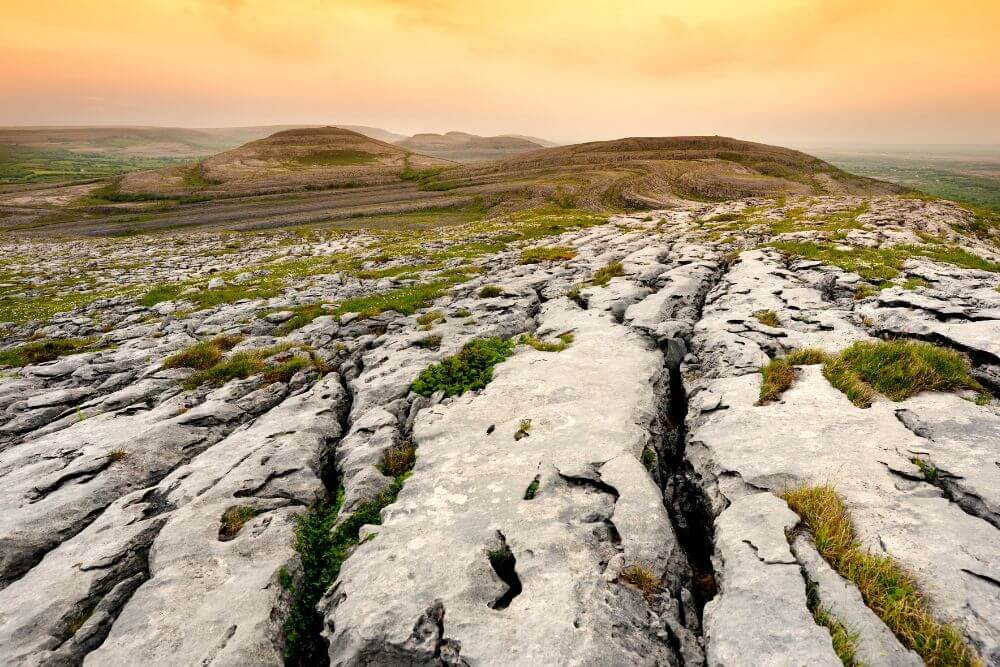

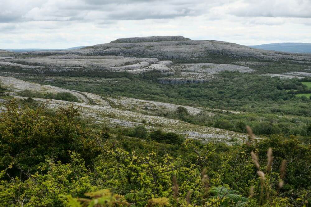
The lunar-like, limestone or karst landscape is quite an amazing sight to see and people often question how it was formed and roughly how old is the Burren.
How was the Burren formed?
Roughly 300 million years ago, the limestone seen in the Burren was laid down in the form of marine deposits in tropical oceans situated near the equator. So if you are to wonder what is the Burren made of, the answer is to a large degree, the limestone rock is made of the shells of sea animals ,such as corals and sea urchins, tiny fossils which formed calcium carbonate (calcite).
(Bonus Tip: Keep an eye out for some fossils that can still be seen in the rock!)
Through several geological processes including the movement of the tectonic plates (caused by the continental drift), uplift of land and the weathering forces of erosion, the exposed limestone pavement surface of the Burren is visible today.
Water has played a particularly important role in shaping the Burren landscape as we know it today.
Limestone rock is permeable, which means that it allows water to pass through it. Over time, this has led to the development of several different types of underground and above ground features in the Burren.
What features can I see in the Burren?
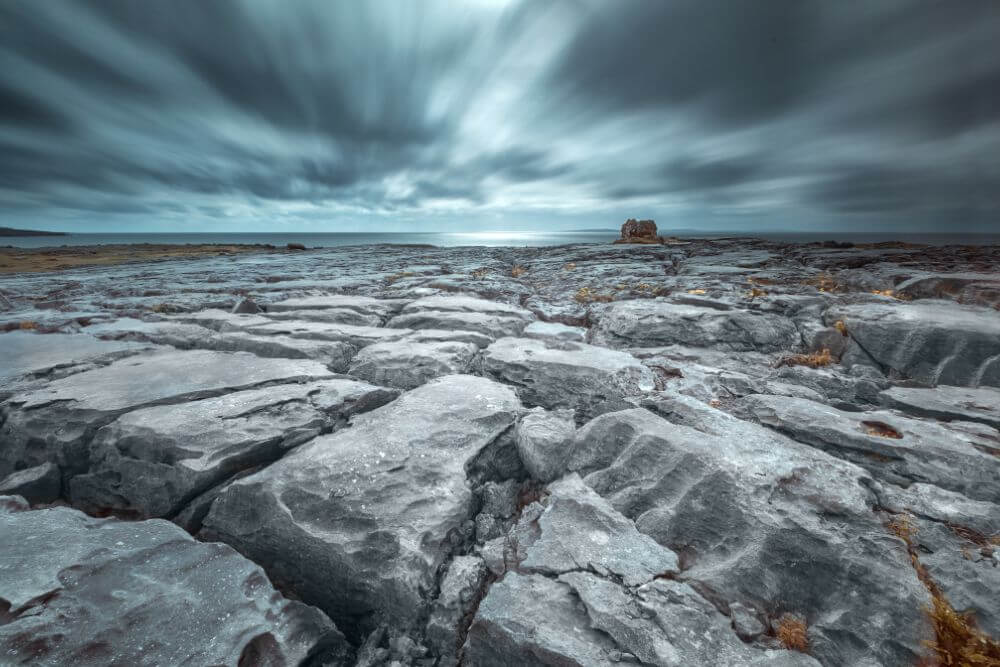
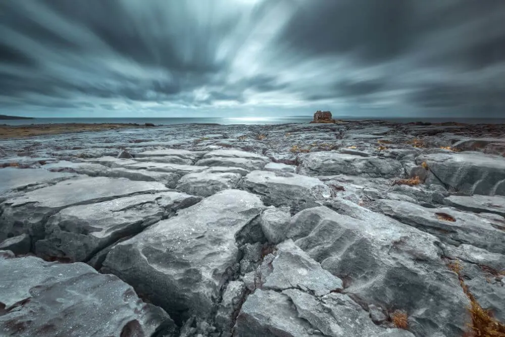
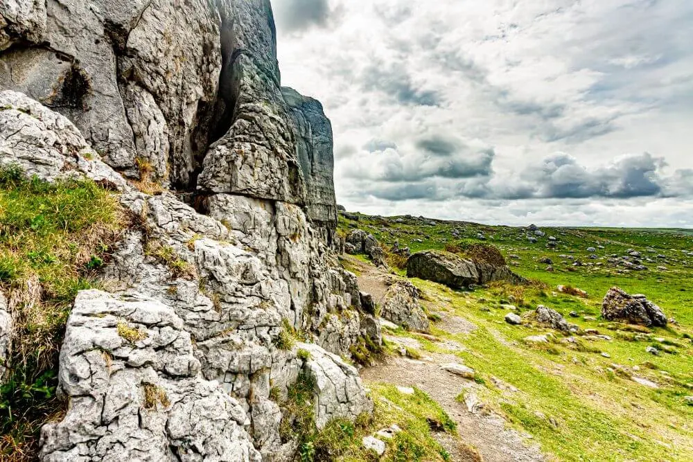
Clints and Grykes
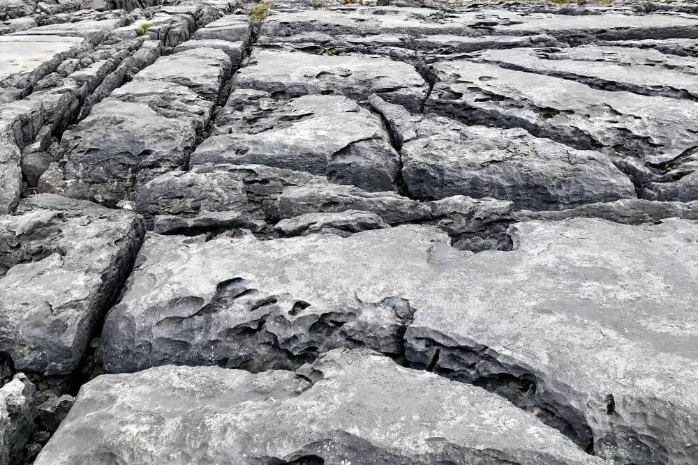
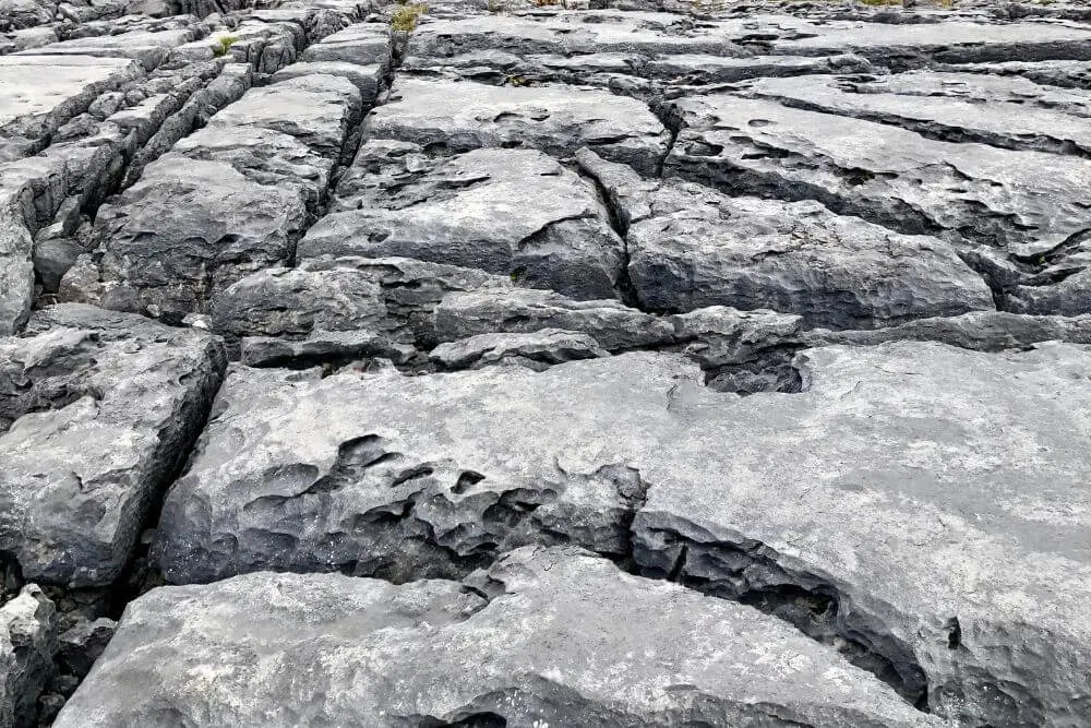
There is also plenty of evidence of the forces of erosion at work in the limestone pavements. Here there is a visible pattern of channels in the surface of the rock, which are called clints and grykes. (Clints are the blocks and grykes are the cracks or fissures between the blocks.)
The clints and grykes, as well as hollows between the rocks are home to a range of species that survive on the small amount of humus, a type of soil organic matter ,that accumulates in the little nooks and hollows.
Through the process of weathering, the grikes can become quite deep, up to about 6 meters in some cases.
The Burren Caves
There are many caves scattered across the landscape, such as the popular tourist attractions of Doolin Cave and Aillwee Cave near the town of Ballyvaughan.
Aillwee Cave is thought to be one of the oldest in Ireland. Its name comes from the Irish, Aill Bhuí, which means “yellow cliff”. It was only first discovered in 1944, by a local man, who kept the presence of the cave system a secret for close to three decades. In 1973, when cavers came to the area, he told them of his extraordinary discovery.
Turloughs – The Disappearing Lakes of the Burren
As well as having many underground streams and rivers, the Burren is also home to lakes that occasionally appear and disappear, called turloughs. This particular type of ecosystem is almost exclusively found in Ireland.
Turloughs usually fill with groundwater in autumn and the lake that forms stay until about springtime, when ground levels reduce and cause the water to disappear into a swallow hole beneath the Turlough. These temporary ecosystems are very important important habitats for many different species, including the smaller sized beetles, flies, butterflies, moths, as well as many amphibians (frogs or newts) and even the very occasional fish (sticklebacks, pike or eel), which may surprise you.
The Burren Cliffs
One of the most well known cliffs in the Burren is Ailladie Cliff, (which is locally known as Ballyreen Cliffs and Ballyreen Point). This cliff is a regular spot for shore-angling, and is also one of the best areas for technical rock climbing in Ireland (but certainly not for novices!) As always, please take extra care near cliff edges as there have been accidents here in the past.
The Burren Mountains
The Burren is a fairly low lying area so it’s “mountains” are relative and usually could be best described as hills! In the Burren, the highest point is Slieve Elva at 345 meters (ca. 1130 ft) above sea level. Within the Burren National Park the highest point is Knockanes, which is 207 meters (608 ft) . The well known Mullaghmore hill is about 180 meters above sea level (590 ft).
The Burren History
While the ancient east coast archaeological treasures of Ireland are well known, the Burren is also an area of significant archeological interest dating back thousands of years.
There has been evidence of humans about 7000 years in the Burren area.
Recently a shell midden (basically the remains of a waste tip from the past) was found in Fanore which dates back about 6,000 years old.
The earliest remains found across the landscape of the Burren stem from the Mesolithic stone settlements (such as the stone settlement that can be seen beside the Burren Way walk near Fanore).
Neolithic Monuments
There are also numerous burial tombs in the Burren built during the Neolithic period that are still visible on the landscape.
Poulnabrone Portal
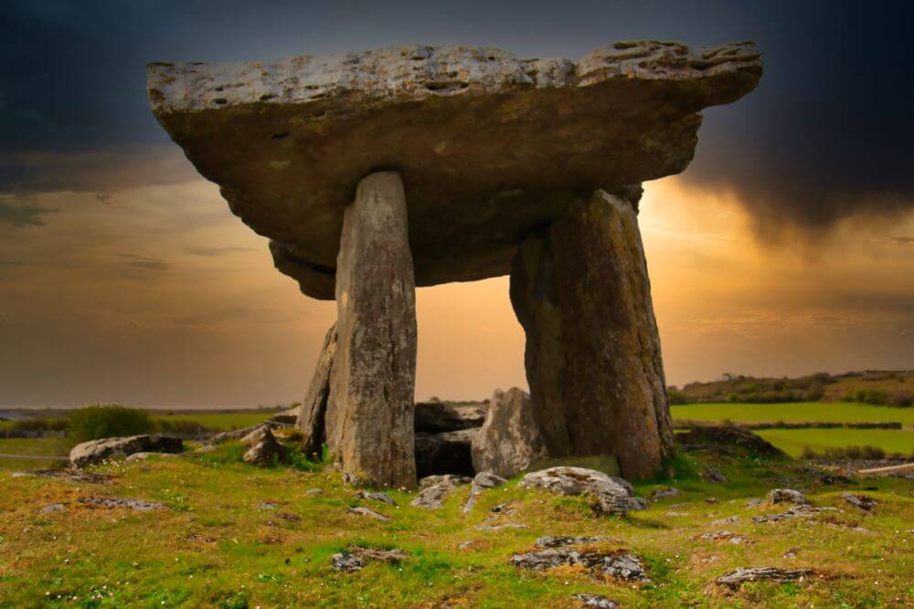

The most famous of these monuments is the Poulnabrone Dolmen, otherwise known as the Portal Dolmen. This iconic feature on the landscape is one of the most well known landmarks in Ireland.
What is a portal dolmen?
This large portal dolmen consists of one large capstone and upright stones, known as portal stone and smaller upright slabs called orthostats. Originally the capstone is thought to have been horizontal however, over time the cap stone has tilted.
The dolmen is close to 2 meters tall (ca. 6.5 ft) and is the second largest in Ireland. Given the weight of these massive stones and the construction tools available when it was built, this megalithic monument is exceptionally impressive.
During a site excavation in 1986 and again in 1988, lead by the archeologist Dr. Ann Lynch, the human remains of sixteen adults, six children and one newborn baby from around 3800 B.C.E. were uncovered from the burial chamber.
Other items including beads, pottery and a stone ax were also found at the site during the excavations.
Wedge Tombs in the Burren
Other types of burial tombs, such as wedge tombs, are found in great numbers in the Burren (roughly 80 in total). A wedge tomb is smaller than a portal tomb, but also has a flat capstone and is supported by upright stones that become narrower at one end.
The Gleninsheen Wedge Tomb is the most well known of these. During excavations at the site a crescent shaped gold neck ornament called a gorget was found (Tip: check out the gold exhibition in the National Museum of Ireland to see it).
There are also four Court Cairns in the Burren, which were thought to have been used for a combination of rituals and burial purposes.
Fulacht Fias – For cooking, bathing or brewing?
The Bronze Age saw the arrival of Fulacht fias to the area. These rectangular troughs in the ground, found near a water source are thought to have been a kind of a multifunctional kitchen, possibly used to cook meat, but their exact purpose is not yet clear.
Stones were heated on a fire and these roasting hot stones were then tossed into a pit filled with water. Meat is thought to have been placed in the hot water to cook.
An alternative use that has been suggested for Fulucht fia is that they were a place of bathing or washing. One of the main reasons for this is the general lack of bones, which would be expected at such sites had they been used to cook meat.
One of the most interesting recent suggestions claims that these pits were actually used to make beer and the hot stones in the water were used to heat barley, which was later allowed to cool and ferment. This is certainly an interesting and plausible suggestion.
Ring Forts in the Burren
Ring forts in the Burren date back to both the Bronze and Iron ages.
Some forts consist of earthen mounds (called Rath) while others were made of stone (called Lois). Earthen forts had a wooden palisade built around them as a form of additional defense, while outside the forts there was often a deep ditch, which was planted with brambles and hawthorn to limit intruders.
Although the main purpose of a fort was to provide shelter for a family and its livestock there is also evidence that they were used for ceremonial events.

The Caherconnell Stone Fort is a well preserved stone and popular tourist attraction in the Burren. Analysis of this fort, shows that it was built more recently, with estimates placing its construction during the 10th century.
Christianity in the Burren
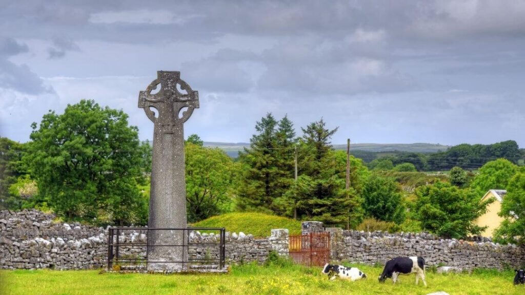
The town of Kilfenora has a long history with the earliest church probably founded around the 6th century. This developed over time to become an important monastic settlement, in which the Kilfenora Cathedral was built in the late 12th century. Several important high crosses are also found here.
(Bonus information for Father Ted fans: Many scenes from this television series were also filmed in Kilfenora!)
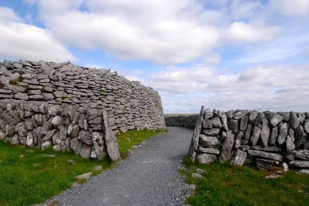
Stone walls of the Burren

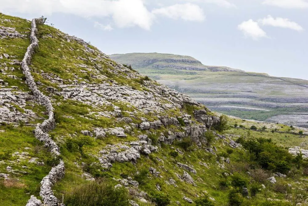
The stone walls seen in the Burren are a relatively recent addition to the landscape, with most dating back to the 17th and 18th centuries. Dating these walls can be difficult and some are thought to be much older, perhaps dating back as far as the Bronze Age.
Flora and Fauna of the Burren

Our full guide to the Animals and Plants of the Burren will give you an in depth guide to the wildlife in this area of Ireland. Below you will find a shorter version.
What plants grow in the Burren?
As many as 75% of Ireland’s plant species grow in the Burren making it one of the richest areas of plant life in Ireland. As an area renowned for its biodiversity, the flora of the Burren is truly unique.
One of the most interesting aspects of the Burren flowers is that plants that are usually found growing in very different habitats and conditions grow together in the Burren. The colorful wild flowers of the Burren are truly a sight to behold. Make sure you tread carefully and take care not to damage them, if you do get a chance to see them in person.
Plants that are usually found in acidic soils with a lower pH (called calcifuge plants), such as Common Heather (Calluna vulgaris) grows beside Bloody Cranesbill (latin: Geranium sanguineum).

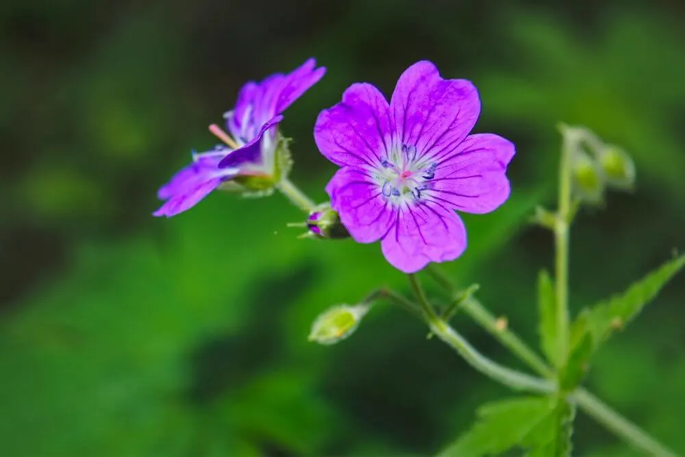
This plant species prefers more neutral or alkaline soils where the pH is higher. (This type of plants are called calcicole plants or “lime loving”). During June, July and August, the flowers are a strong magenta color which later fade to violet. At the end of summer, when autumn arrives the color of the leaves changes to bright red.
Other plant species that are usually found in Arctic or sub-Arctic environments grow next to species that typically have an Alpine or Mediterranean distribution.

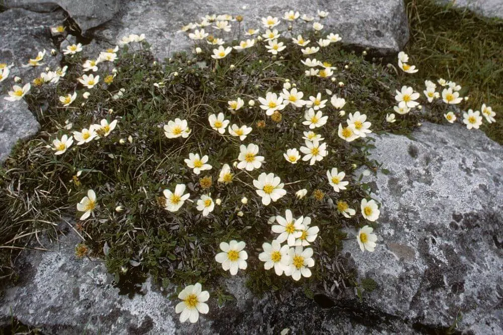
The Burren flora is famous for its bright blue Spring Gentian (Latin: Gentiana verna), these are typically found in Arctic-Alpine areas, but grow close to sea level in the Burren. Mountain Avens (latin: Dryas octopetala) is another plant more usually accustomed to colder or higher altitudes, but that grows well in the Burren.
Orchids of the Burren
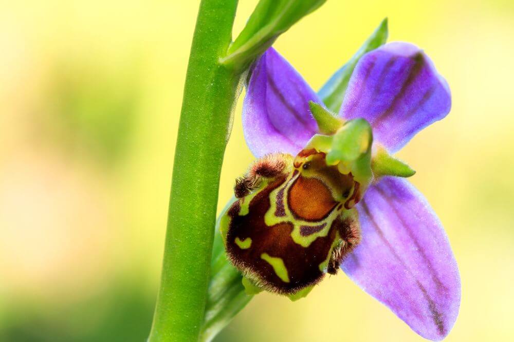
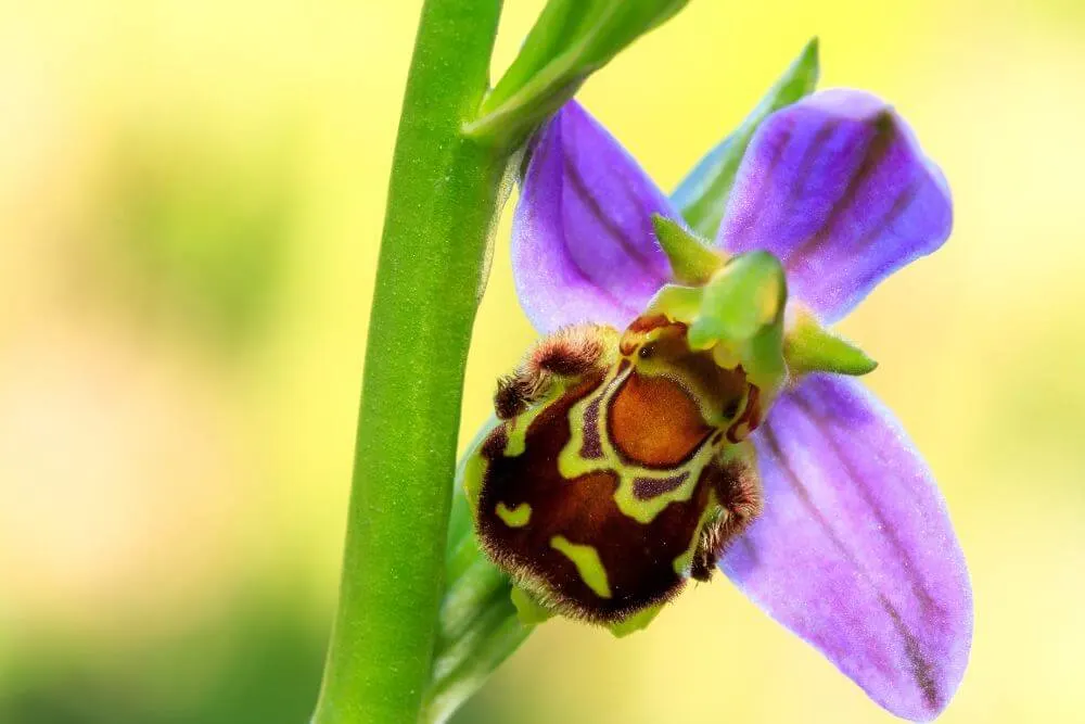
There is also a wide range of orchid species found in the Burren (27 of Ireland’s 31 native orchid species grow in the area). Some of the most notable Orchids found here include the Bee Orchid (Ophrys apifera), which has markings that mimic those of a bee inorder to attract pollinators. The species of bee it tries to attract does not live in Ireland (Eucera longicornis ), and therefore usually self pollinates. Other common orchid species include the Early Purple Orchid (Orchis mascula), the Pyramidal Orchid (Anacamptis pyrimidalis).
There is also an orchid O’Kelly’s Spotted-Orchid (Dactylorhiza fuchsii var. okellyi) that was named after a local amateur botanist, Patrick Bernard O’Kelly, who ran a small nursery in Ballyvaughan specializing in rare plants that he collected in the Burren in the early 20th century.
What animals live in the Burren?
There is a wide range of animals in the Burren. These include larger mammals such as Feral Goats, Foxes, as well as smaller mammals including Mink, Irish Stoat, Otter and Pine Martens.
Vole, Red Squirrel, Wood Mouse and Pygmy Shrew populations are also present in this landscape.
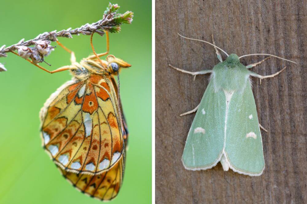
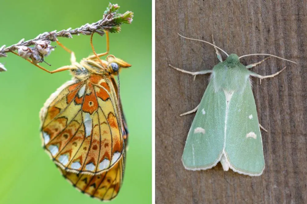
Many species of butterflies and moths are found in the Burren, including these stunning species, Pearl-bordered Fritillary (Boloria euphrosyne) and the Burren Green Moth (Calamia tridens).
Protected species, such as the rare Lesser Horseshoe Bat, the Irish Mountain Hare and the Badger also live in this environment.
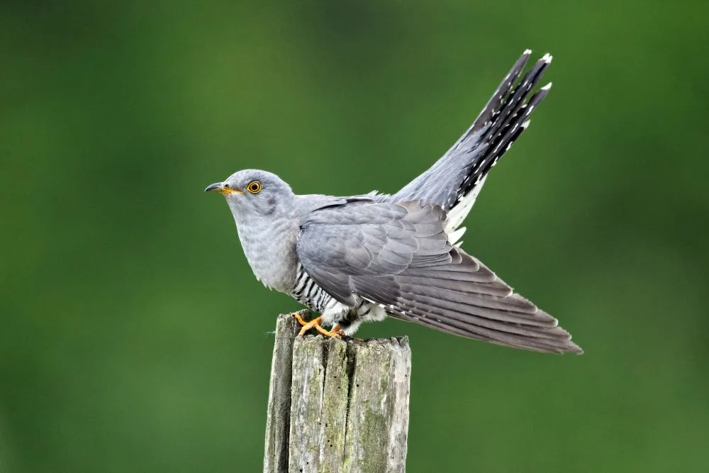
There are many important bird species in the Burren including Barn Owls, Little Egret and the Cuckcoo. Keep an ear out if you visit for its distinctive “cuckoo” call.
The Burren Facts
Here are five interesting facts about the Burren region in Ireland:
1. The Burren and J.R.R. Tolkien
Did you know that there is a supposed connection between J.R.R. Tolkien and the Burren? During 1949 and 1959, Tolkien spent time working as an external examiner of English at the University College in Galway and is known to have visited the Burren on multiple occasions. It was around this time that he revised and published The Ring Trilogy.
There is even a cave in the Burren, to the east of Slieve Elba, called Pól na gColm (or in English, Poulnagollum). Did this barren landscape help give him inspiration for his famous works? There appears to be evidence to support this based on the manuscripts and papers that belonged to Tolkien to back up this claim!
2. Brown Bears of the Burren
The remains of 2 brown bears have been found in Aillwee cave. The bones were dated using radiocarbon dating analysis and the skull was found to be 10,400 years old. (A recent study of a bear bone from another cave in County Clare, Alice and Gwendoline Cave (not in the Burren), found butcher marks (lines carved in the bone) made by a human. These marks were made while the bone was fresh 12,500 years ago. What makes this find particularly significant was that it revealed the presence of humans in Ireland 2,500 years before it was previously thought.)
3. Lisdoonvarna Spa Town
The town of Lisdoonvarna has been attracting visitors to these therapeutic mineral waters that are rich in iron and sulfur for over 200 years and opened its first bathhouse in 1875. The natural springs are a result of the geology of the area, which consists of Clare Shale on top of limestone rock.
4. The Great Stalactite of Doolin Cave
In Doolin Cave, (also known as Pol an Ionáin), it is thought that the Great Stalactite is one of the longest free-hanging stalactites in the world, and certainly the longest in Europe. It has taken about 70,000 years for the 7.3m (24 ft) to form, one drop of water at a time.
5. Glacial Erratics
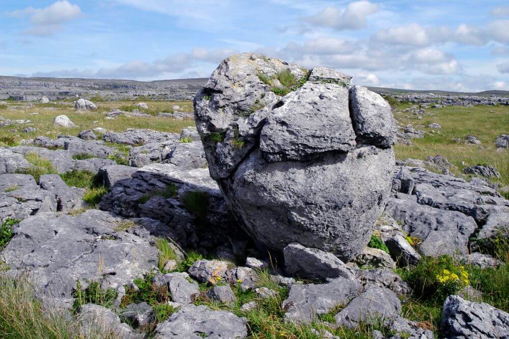
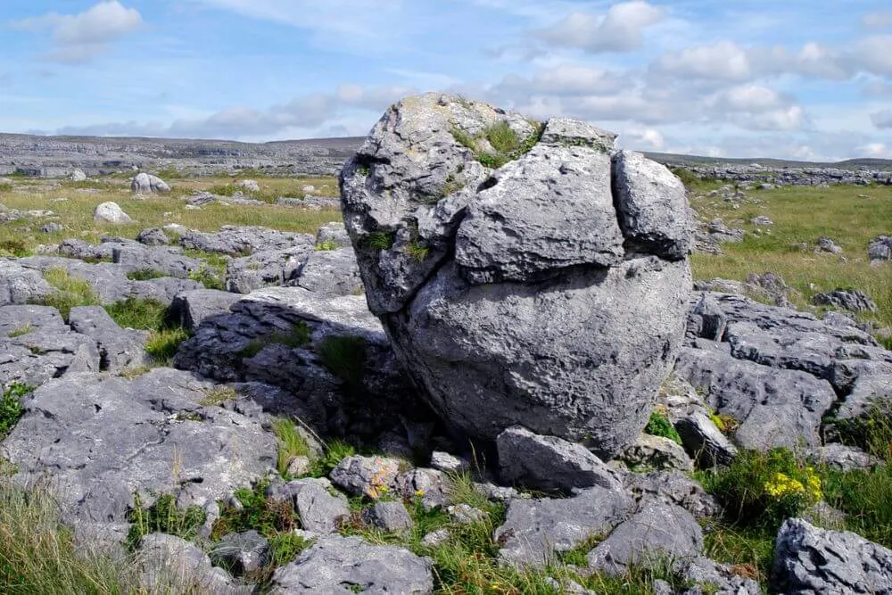
Large boulders are occasionally found scattered across the limestone pavement (such as the one near the Poulnabrone Dolmen). In many cases the boulder rock type differs from the surrounding limestone. These boulders are called Glacial Erratics and were transported (sometimes great distances) in glacial ice sheets and deposited on the landscape when the ice melted at the end of the last glacial ice age period (almost 16,000 years ago)
FAQ about the Burren Region Ireland
By foot, bike or car – How to see the Burren in Ireland?
If you allow yourself some time to walk through the Burren (see the trail suggested above), you are likely to get a completely different experience than just driving through the landscape. This option isn’t possible for everyone though. Exploring the region by bicycle is another option and there are some cycle routes available.
There are also many interesting areas to explore by car, as well.
Can you drive through the Burren?

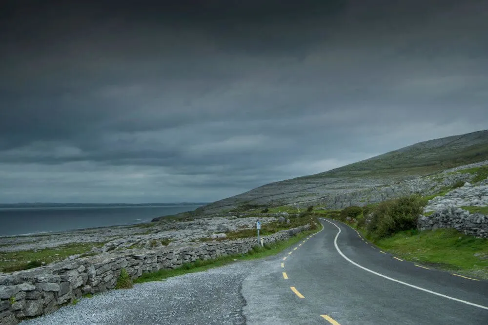
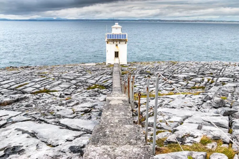
Yes, it is possible to drive through the Burren. The regional road, R477, is just one of the many scenic drives in the area. It follows the coastline around from Ballyvaughan, near Gleninagh Castle, around Black Head Lighthouse, past the stunning Fanore beach before heading back inland close to Doolin cave and finishing the Lisdoonvarna.
How much does it cost to visit the Burren?
Entry to the Burren and the Burren National Park is free. Please respect this very unique part of Ireland, enjoy your visit but leave no trace of it.
What is the distance from Ennis to the Burren?
The journey by car to travel from:
- Ennis to the Burren National Park takes roughly 25 minutes to drive (ca. 21 km or 13 miles).
- Ennis to the Burren National Park Information Point (small free visitor center open between April and September) takes roughly 14 minutes to drive (ca. 13 km or 9 miles).
- Ennis to Ballyvaughan takes about 45 minutes to drive (ca. 37 km or 23 miles)
- Ennis to Lisdoonvarna takes about 36 minutes (35 km or 21 miles)
- Ennis to the Cliffs of Moher takes about 40 minutes (40 km or 25 miles)
What is the distance from Doolin to the Burren?
The journey by car to travel from:
- Doolin to the Burren National Park takes roughly 31 minutes (ca. 27 km or 17 miles).
- Doolin to the Burren National Park Information Point (see details above) takes roughly 30 minutes (ca. 26 km or 16 miles).
- Doolin to Ballyvaughan takes about 28 minutes (ca. 23 km or 14 miles)
- Doolin to Lisdoonvarna takes about 9 minutes (ca. 7 km or 4 miles)
- Doolin to the Cliffs of Moher takes about 17 minutes (ca. 11 km or 6.8 miles)
Is the Burren in Ireland a Harry Potter filming location?
No, but some scenes of the Harry Potter and the Half-Blood Prince (the sixth movie in the Harry Potter franchise) were filmed at the Cliffs of Moher. Find out more here.